
Follow a McLean Street by Address
Fairfax County keeps McLean address evidence in several systems, not in one household roll. Begin with the delivery-style address, then keep the parcel ID, tax-map reference, and legal description beside it. The Department of Tax Administration can tie a McLean situs to a parcel and an owner or mailing line. GIS then puts that parcel on the block. The Circuit Court land-record index supplies the recorded transfer trail, while voter products and old reverse directories have their own access rules and dates. This order makes by-street research repeatable and avoids treating a postal label as proof that a person lives there.
- Normalize the full McLean address, including a unit when one is known, and search it in iCare.
- Save the parcel ID and tax-map reference, then inspect the street segment in Fairfax GIS.
- Use the parcel owner or recorded party to locate an instrument number, grantor, grantee, or deed book and page.
- Check permits, plats, and historical map context by site address or parcel rather than by street name alone.
- For a dated household clue, compare the printed address with the Fairfax directory collections and preserve the volume and page.
Numbered buildings, condominium units, subdivision lots, and older road names can each change how a McLean street search behaves. Record why a query failed before changing the search terms.
Search McLean Street Directory iCare Fields
The free Fairfax iCare address search is the practical first stop for a McLean by-address search. It supports address, owner, tax-map, and map routes. For a whole street, leave the number empty, enter the street text, and leave the suffix empty for broader results. The portal accepts partial street text and its documented examples include wildcard use. Results should be read as parcel and assessment records, not a roster of everyone at a McLean address. Ownership and sales information is updated twice weekly, while assessed values are as of January 1.
| iCare field | Input | Street-search use |
|---|---|---|
| Number | Optional text | Leave blank to browse a McLean street. |
| Unit# | Optional text | Add a condominium or apartment unit when known. |
| Street | Optional text | Use a name such as 819 Woodland or a partial wildcard form. |
| Suffix | Optional dropdown | Omit it for a broader match; the portal controls the suffix list. |
| Sort and results/page | Optional dropdowns | Adjust result order and the number of visible results. |
| Search | Button | Runs the McLean address query. |
The official iCare form is shown in this Fairfax County capture.
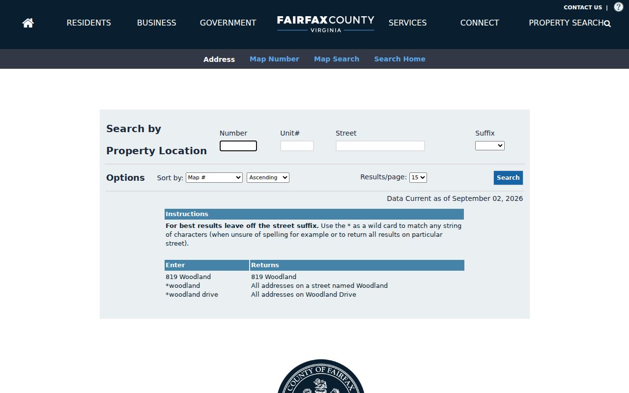
Use the form to create a parcel list for a McLean street, then verify each selected parcel in the map and deed systems.
Note: The iCare street suffix is optional, so a blank suffix can recover a result that an exact-form query misses.
Map McLean Street Parcels
The Fairfax Digital Map Viewer adds the spatial layer a McLean address search needs. Search an address or place, choose a map type, year, and tax-map tile, then retrieve the selected map. The viewer displays current maps and listed years from 1960 through 2026 across 444 tax-map grid tiles. Parcel edges, tax maps, streets, address numbers, lot numbers, buildings, and water features help distinguish a road-facing parcel from a rear lot or shared drive. Zoning, flood, sewer, and contour layers supply context, but the county says deeds remain the authority for legal boundaries and easements.
The Digital Map Viewer places its address, map-year, tile, and selected-map controls in one official interface.
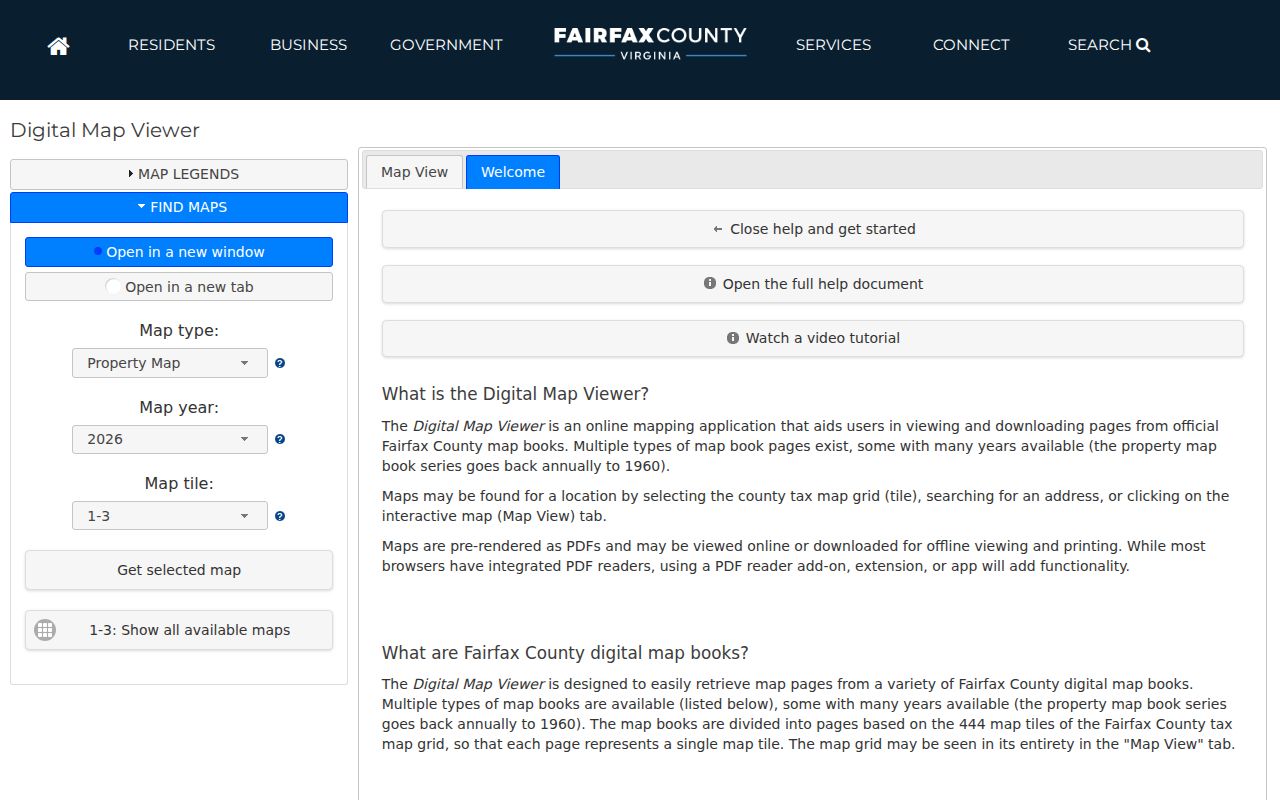
Save the McLean map year and tile with the parcel ID. Those details help bridge a current street label to a map or deed that uses a different description.
Match McLean Street Directory Records
A McLean by-street search is strongest when every result carries an evidence label. iCare supplies the tax parcel. MAR and GIS provide authoritative site-address and parcel infrastructure. The Circuit Clerk records instruments and plats. PLUS, LDIH, and SRV divide planning and land-development history by system and date. Virginia voter records have a controlled request path, not an open street browser. Printed directories and newspapers add a dated name or address entry. Each source belongs in a separate column of a research log.
| McLean address source | Key | What it can establish | Access channel |
|---|---|---|---|
| iCare tax parcel | Street, number, unit, parcel | Situs, owner or mailing line, assessment, sales, characteristics | Free web, phone, or office |
| MAR and GIS | Address, parcel, tax map | Site position, geometry, adjacent parcels, district layers | Free web map, PDF, or service |
| Deed index and images | Grantor, grantee, legal description | Recorded parties, instrument, date, book/page, plat references | CPAN, Research Room, or Historic Records Center |
| PLUS, LDIH, SRV | Site address, parcel, record number | Permits, plans, inspections, status, and complaint history | Public search with VFOIA fallback |
| Voter list product | Residence address and district | Statutorily available registered-voter fields | Request and certification process |
| Directory or newspaper | Printed street and address | Dated historical occupant or business clue | Virginia Room, archive, or microfilm |
Use the parcel or legal description to join systems. A street name alone can be normalized differently by the tax roll, a deed, and a historic printed entry.
Read McLean Street Address Labels
One official McLean parcel sample makes the distinction clear: the site at 1515 Chain Bridge Road has a separate mailing address line. A mailing contact can be elsewhere, can use a care-of line, or can carry another McLean ZIP. That difference is evidence, not a correction to make. A deed may be more exact than the street label because its legal description identifies the land conveyed. When a lot was split, compare the parent parcel, plat, and prior reference before deciding that a later document transferred the entire site.
- Parcel
- A Fairfax tax-map-based land unit used to connect assessment, map, and recorded-property research.
- Situs address
- The physical property location used by the tax roll, which may differ from the tax mailing line.
- Plat
- A recorded map that can identify subdivision lots, rights-of-way, and the relationship among parcels.
- Criss-cross directory
- A reverse address arrangement of printed directory entries, useful only for the dates and streets that a volume covers.
For McLean street work, preserve the original address string and the record system that supplied it. Do not replace a legal description with a postal label.
Trace McLean Street Deed Chains
The Fairfax land-records research service connects a McLean parcel to deeds, deeds of trust, liens, releases, plats, and easements. Search by a recorded party, instrument number, or deed book and page. The public Research Room offers a free path, while CPAN is the subscriber route and pre-1945 deed books remain a Historic Records Center task. The Research Room is open Monday through Friday, 8:00 to 4:30; staff can help with the index but do not perform the research for a requester.
This Land Records Research capture identifies the county channel for the broad digital collection.
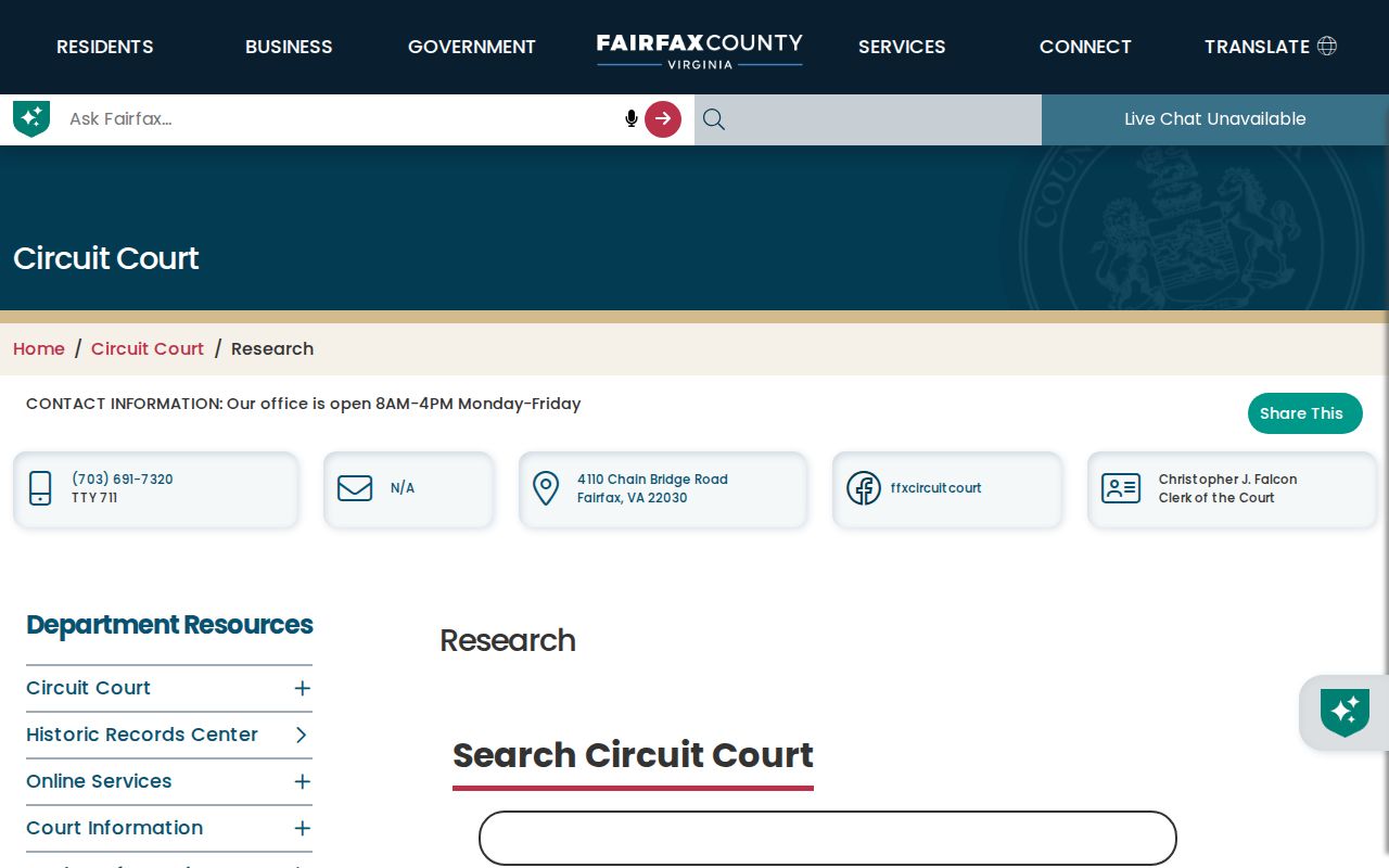
Copy the grantor, grantee, recording date, instrument number, book and page, and legal-description reference from each McLean result before pursuing the preceding transfer.
McLean Street Search Insider Tip
Use a broad iCare street query before assuming a McLean address was never assessed. Leave the number blank for a street-level result list, omit the suffix, and try the documented wildcard form such as *woodland. Then narrow from the parcel list, not from a guessed owner name. This is useful when a printed source shortens a road name or when a street has units. A hidden owner name does not mean the county lacks the tax record: under Virginia Code §58.1-3122.2, an owner may withhold the name from the internet display while it remains available from the office or by phone.
The paid Court Public Access Network is different from iCare. CPAN provides fuller court and land-record modules for subscribers, while iCare is the free parcel starting point.
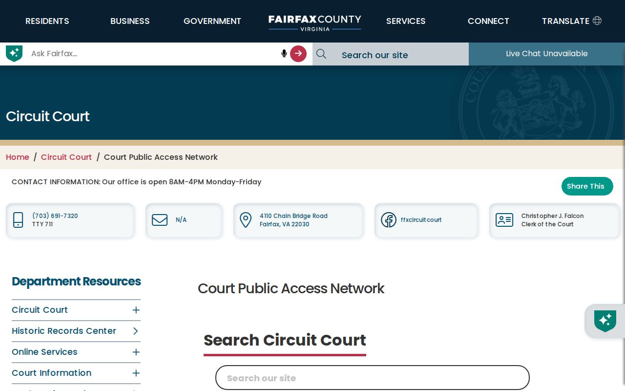
Use a McLean CPAN search only after retaining the parcel and recorded-reference details that make the query specific.
Check McLean Street Permit Records
Land-development history can add a separate McLean street record. Fairfax directs users to PLUS for records after its October 31, 2022 launch and to LDIH for legacy building, site, zoning, and complaint information. Search with the exact site address, parcel ID, or record number where the portal permits. A permit can identify an applicant, contractor, plan, inspection, or status. It does not establish that all occupants of a McLean street address are named in the file. When a public search does not provide the needed record, the documented fallback is the county public-records channel under the Virginia Freedom of Information Act.
The Fairfax LDS public-records page explains the PLUS, SRV, LDIH, and VFOIA routes.
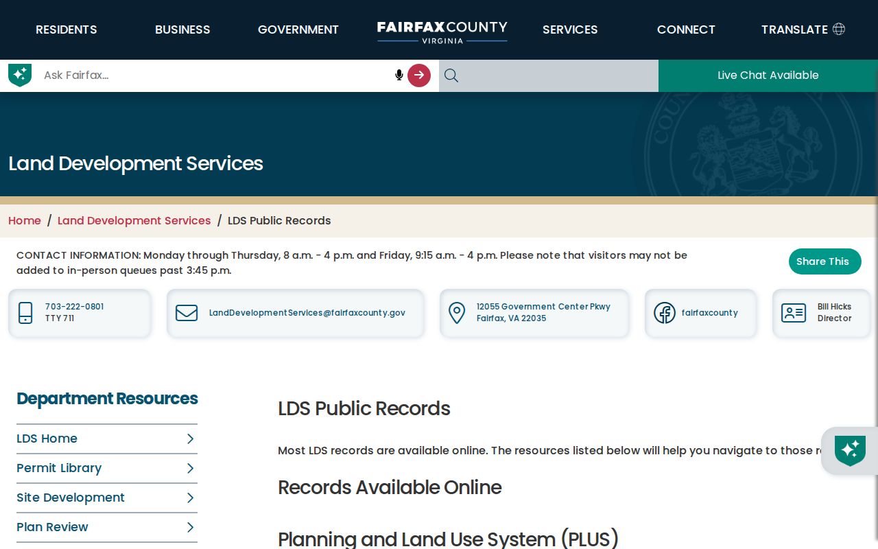
Keep the system name and record number beside the McLean street address so a later search does not confuse a legacy file with a PLUS record.
Use McLean Street Voter Products
Virginia's Citizen Portal is an identity-confirmation route, not a public map of every voter on a McLean street. Status lookup asks for a name, date of birth, last four Social Security digits, locality, and certification. The state voter-list request process may provide defined statutory products, but the requester must choose locality, election, product, and certify responsibility. Public inspection fields include name, residence address, year of birth, gender, and district information; ballot choice, voter ID number, full birth date, and protected-address data are not public.
Fairfax Elections is the local troubleshooting channel if a precinct or status appears wrong. Treat any returned address as a voter-record field with its own date and legal limits, not as a complete household list.
Bridge McLean Street History
Historical McLean street research often needs more than a current address search. Fairfax property maps are available annually back to 1960, and the county GIS collection includes current and historical aerial context. Before that, tax books can describe acreage and distance or direction from the courthouse, while deeds may use metes and bounds or subdivision lots. Fairfax land records broadly reach 1742, but the history is not seamless: specific deed books are missing, and the Civil War caused broader losses. A missing volume is a coverage gap to document, not a basis for inventing a continuous chain.
For dated printed address clues, the McLean city directory collections provide the historical shelf without turning a modern street search into a general name lookup.
Note: A rural-route description, subdivision creation, or road-name change can explain a failed McLean street match without proving that the parcel moved.
Know McLean Street Directory Limits
No McLean by-street search can promise every person at every address. Parcel records often identify an owner or mailing line, not every household member. Deeds identify recorded parties and legal land descriptions, not occupancy. Voter products are limited by statute and protected-address rules. Utility, delivery, DMV, confidential vital, sealed-court, and protected voter information are not a public street roster. A printed directory can also lag a move or preserve an older spelling. Describe a result as an officially indexed owner, recorded party, permit applicant, registered voter product, or historical directory entry, according to its source.
Keep negative evidence too. Record whether a McLean query failed because of a missing suffix, historic name, sealed file, withheld internet display, missing deed book, or no indexed result. That note can prevent a later researcher from repeating the same narrow McLean search and makes the record trail easier to audit. A McLean address log should retain the search date, source name, and exact query form alongside every unsuccessful result.